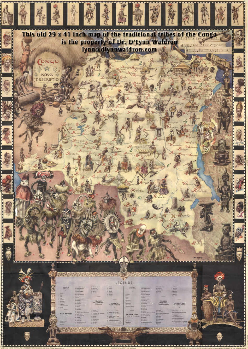
The administrator of Kasai province in the Belgian Congo in 1960 was so disgusted with Belgium's greed motivated betrayal of their Colony that he took his pair of prized old maps of the Congo off his office wall and gave them to me. The map I treasure shows the major tribes of pre-colonial Congo with a examples of their art. The original map is 29 x 41 inches, and this is a scan of it that I did in 12 sections at 300 dpi and fitted together and then also made into a small jpeg to put on the web. ![]()